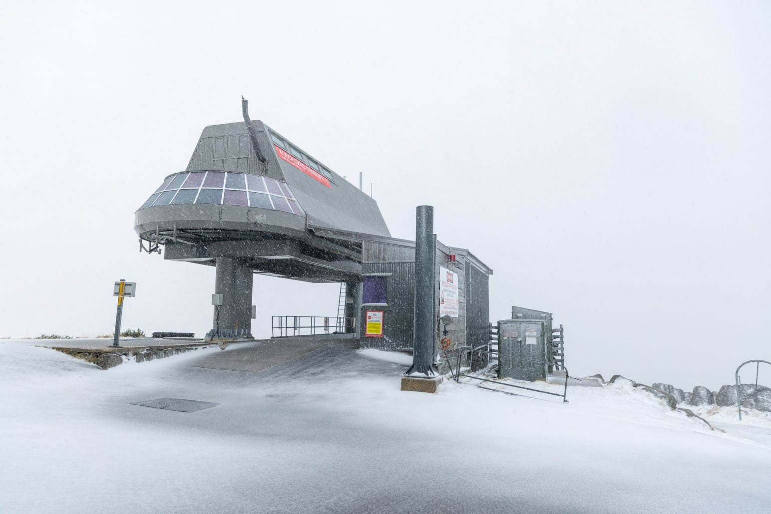
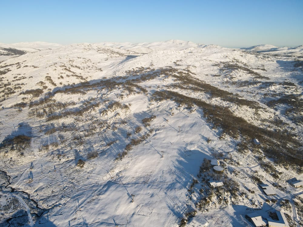
The NSW resorts of Perisher, Thredbo and Charlotte Pass have received an early white covering of snow which is encouraging for the winter ahead.
Snow fell for most of Wednesday and into the evening before clearing Thursday morning. With more snow predicted this coming weekend, it starts the cycle of the ground cooling, and important phase in the early season process.
"A great start for the upcoming winter and it has certainly cooled the Mountain down. With a follow-up fall predicted over the weekend it is a positive sign for the upcoming snow season," said Michael Fearnside, Perisher Operations Director on the 5-10cm snowfall overnight at Perisher:
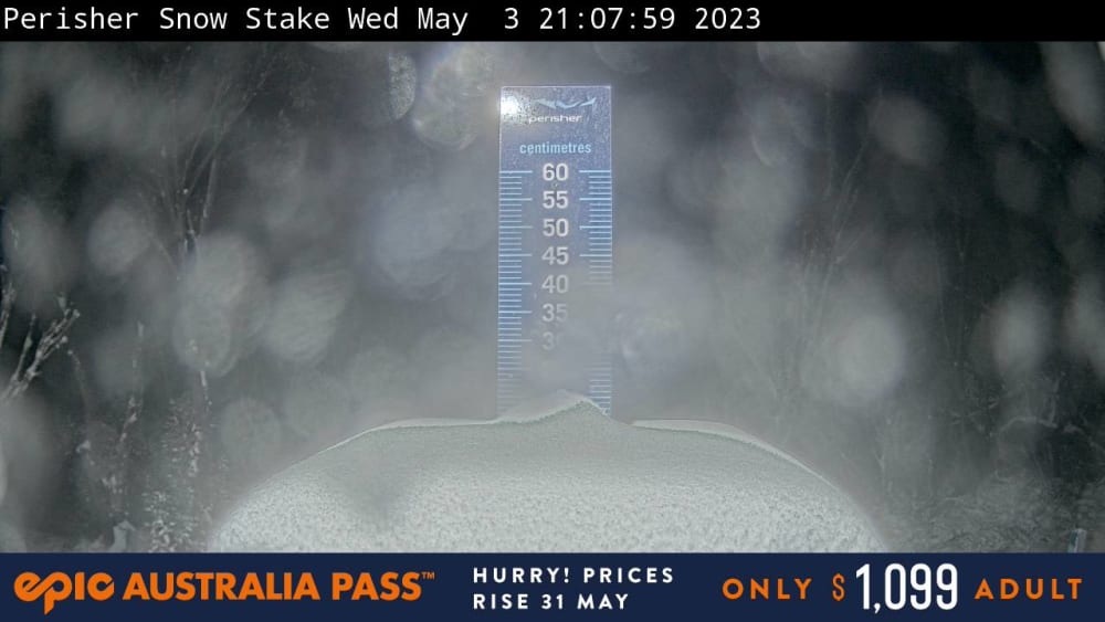
The Perisher snow stake on Wednesday evening actually showed over 20cm, but we all know it quickly settles. It certainly looks like 15cm or more and is a great start for early May. While the snow will melt somewhat once the sun hits over the coming days, the follow up snowfall this weekend, or any decent fall in May would be a huge bonus for the early 2023 winter season.
Looking at the Bureau of Meteorology Snowy Mountains weather forecast, there is another front approaching.
A ridge of high pressure extends across New South Wales bringing a return to stable conditions and cool and frosty mornings. During the weekend, another stronger cold front will sweep across the state, bringing a major cold snap in its wake, with a low pressure system possibly developing offshore off the far South Coast on Sunday.
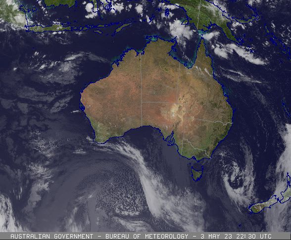
High-level cloud ahead of a cold front can be seen passing over southwest Western Australia. There is low cloud about coastal South Australia, Victoria and Tasmania associated with onshore flow. Photo courtesy of the Bureau of Meteorology.
The Perisher snow stake on Wednesday evening showing a healthy accumulation of 20cm.